As always, click any photo for big. Click again for bigger. Hit your back button to return to the post
There is ample parking at the trail head located adjacent to the Rail Road Bridge.
Click Here for driving directions
Click Here for the GPS of this ride.
Click Here to see all the photos on Google +
Click Here if you prefer Flickr
| Distance: | 24.48 mi |
| Time: | 3:16:29 |
| Moving Time: | 2:31:23 |
| Elapsed Time: | 3:16:29 |
| Avg Speed: | 7.5 mph |
| Avg Moving Speed: | 9.7 mph |
| Max Speed: | 19.2 mph |
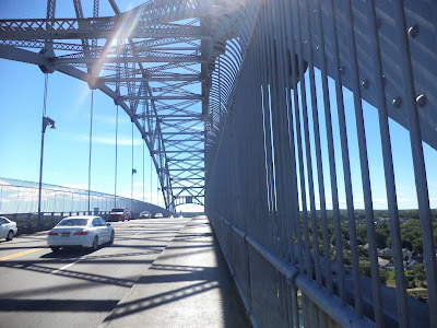
A short ride from the southern canal entrance brought me to the access for bikers and walkers to cross the Bourne Bridge to the cape side of the canal. From there it's necessary to back track a bit to get to Mashnee Island and the southern terminus, across the canal from Mass Maritime Academy. Here is where I came across a very old cemetery that has people who were born in the seventeen hundreds. One of the lesser known history items of this area is The King Phillip War in the 1690s. Many familiar names from that war are common around these parts. Narragansett, Pocaset, and Cataumet are but a few of the common names of that era.
Crossing the Bourne Bridge
Mashnee Island
This was the oldest gravestone with legible markings.
Massachusetts Maritime Academy at the southern end of the canal looking from Mashnee Island
After getting back on the canal path it's a wind at your back seven mile ride to the north end of the canal at Sandwich, MA and the power station.
North end of Canal looking from the Cape side.
The Cape side of the canal path has much less traffic than the mainland side and it's easier to let loose and get some speed up while biking. The power station is the turn around spot and it's a short ride to the bike access to the Sagamore Bridge via the Christmas Tree Shop parking lot. Traffic was getting heavy this Sunday afternoon with all the tourists driving off the cape making their way home. Lots of New York, Connecticut and New Jersey plates today.
Traffic was beginning to build with the tourists leaving the cape via the Sagamore Bridge
After crossing the Sagamore bridge I again rode to the north end of the canal across from the Sagamore power plant. There a huge tug and barge entered the canal prompting everyone with a camera, including me, to scurry to the shore line snapping away. After all that excitement it was time to begin the seven mile return bike ride back to the southern end of the canal.
Tug and barge entering the canal from the Boston side.
There were lots of people on this side of the canal both on the path or simply hanging around at the overlooks. Fishermen, bikers, walkers and people who brought a chair and a book simply enjoying the activity on the canal. Boat traffic on the canal was pretty heavy with mostly pleasure boats. Every now and then something big would make it's way up the canal and those got everyone's attention.
Spending time at the canal is a great way to get outdoors and enjoy a beautiful late summer day. If your around here, try it, I bet you'll love it. And you could make a new friend like I did.
My new friend. Click the photo to enlarge for a better look.


John, I've never road across the bridges before. Maybe one of these days I'll try it?
ReplyDeleteThe signs suggest we walk over the bridges. I walked.
ReplyDelete